An important — and maybe the most anxious — stage of the scientific method occurs when someone’s reported discovery is subjected to independent verification. Arctic exploration goes through the same process. After Peary had announced his sighting of Crocker Land, confirmation by a second party was imminent. This page examines expeditions led by other explorers to locate and, if possible, to plant a flag on Crocker Land. Eventually, these efforts led to the conclusion that Peary’s “hypothesis” was a false one.
Donald MacMillan and the Crocker Land Expedition
There’s little doubt that the expedition most devoted to finding Crocker Land was led by Donald MacMillan. In fact, in a 1913 promotional brochure, his journey is officially called the “Crocker Land Expedition to the North Polar Regions.” The same source also points out that, while the first object was “To reach, map the coast line and explore Crocker Land,” other goals were to seek additional land, to learn about the meteorology and glaciology of Greenland’s ice cap, and to study a wide variety of other things — from seismology to botany — along the way.
Needless to say, Peary saw MacMillan’s expedition as being of the utmost value. In an article for a 1912 issue of The American Museum Journal, he says:
The exploration of Crocker Land easily takes first rank among problems demanding exploration, now that the Poles have been reached and that the insularity of Greenland has been determined. . . . And further than this, should this land, the distant mountain peaks of which I was fortunate enough to see from the summit of Cape Thomas Hubbard in July, 1906, prove to be a land of large extent, the possibilities will be most alluring, for such land will become the gateway to other lands or seas represented by the large blank space on the maps between the North Pole and Bering Strait.
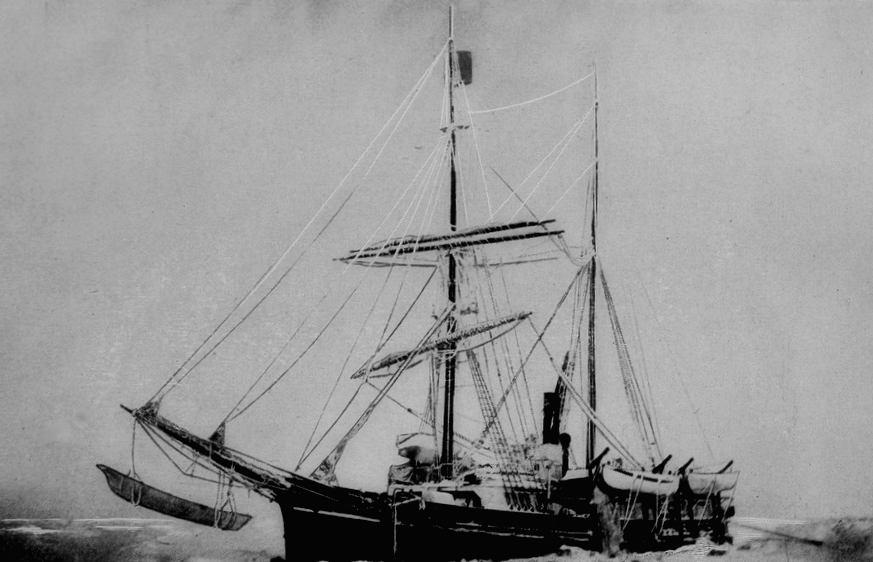
The expedition was originally planned to depart in 1912, but this was postponed due to the drowning of MacMillan’s co-planner, George Borup. In July of the following year, MacMillan and his crew finally embarked upon their journey. (According to this article, both the MacMillan and Stefansson expeditions, the latter discussed below, were riddled by calamities.)
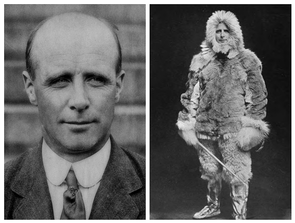
Interestingly, both MacMillan and Borup had been with Peary on the latter’s 1908 expedition, the trip from which Peary returned saying he had reached the North Pole. Both men were located elsewhere, though, when Peary allegedly attained his goal, and that claim came under close scrutiny. Peary’s historic moment became especially debated when Frederick Scott returned about the same time with the news that he himself had been the first man there. As Thomas F. Hall writes in his 1917 book, Has the North Pole Been Discovered?, “neither Peary nor Cook has anything to submit as proof of being the discoverer of the North Pole except a candid narrative.” Since MacMillan’s expedition was spearheaded by Peary’s allies, one might sense that one of its unwritten goals was to bolster Peary’s reliability about his Pole claim by confirming his Crocker Land claim.
And loyalty might partly explain why MacMillan — after finding only icy sea where Peary said Crocker Land should be — went to some length to assure the public that it had been a mirage. In fact, it was so persistent a mirage that he and his colleague had both seen it, too. They even saw it twice from two different locations! In his book recounting the experience, MacMillan explains:
April 21st was a beautiful day; all mist was gone and the clear blue of the sky extended down to the very horizon. [MacMillan's companion, Fitzhugh] Green was no sooner out of the igloo than he came running back, calling in through the door, 'We have it!' Following Green, we ran to the top of the highest mound. There could be no doubt about it. Great heavens! what a land! Hills, valleys, snow-capped peaks extending through at least one hundred and twenty degrees of the horizon. I turned to [Piugaattoq, the expedition's Inuit guide] anxiously and asked him toward which point we had better lay our course. After critically examining the supposed landfall for a few minutes, he astounded me by replying that he thought it was poo-jok (mist). . . . As we proceeded the landscape gradually changed its appearance and varied in extent with the swinging around of the sun; finally at night it disappeared altogether. As we drank our hot tea and gnawed the pemmican, we did a good deal of thinking. Could Peary with all his experience have been mistaken? Was this mirage which had deceived us the very thing which had deceived him eight years before? If he did see Crocker Land, then it was considerably more than 120 miles away, for we were now at least 100 miles from shore, with nothing in sight.
The next day, the team surpassed Peary’s estimate of Crocker Land’s shore by thirty miles. With the air being “clear as crystal,” MacMillan found nothing but disappointment. He writes: “You can imagine how earnestly we scanned every foot of that horizon — not a thing in sight, not even our almost constant traveling companion, the mirage.” The team turned back and managed to find the very spot where Peary had stood and seen land in 1906. According to MacMillan:
The day was exceptionally clear, not a cloud or trace of mist; if land could be seen, now was our time. Yes, there it was! It could even be seen without a glass, extending from southwest true to north-northeast. Our powerful glasses, however, brought out more clearly the dark background in contrast with the white, the whole resembling hills, valleys, and snow-capped peaks to such a degree that, had we not been out on the frozen sea for 150 miles, we would have staked our lives upon its reality. Our judgment then, as now, is that this was a mirage or loom of the sea ice.
Thus, from vantage points both near and far, the MacMillan deemed Crocker Land to be a mirage. This news was first delivered to the American Museum of Natural History in November of 1914, and Green reiterated it upon his return to New York in September, 1916. Peary, it seems, was the victim of an Arctic visual phenomenon that only the most expert eyes can recognize as merely poo-jok.
Vilhjalmur Stefansson and the Canadian Arctic Expedition
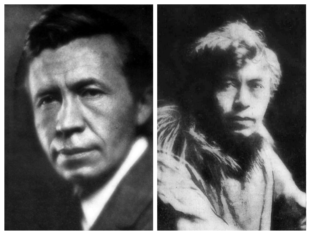
When MacMillan’s expedition for the U.S. embarked, Vilhjalmur Stefansson was already heading north on behalf of Canada. Rather than verifying Crocker Land, though, this expedition was intent upon discovering new land and assessing the accuracy of old maps. Regarding the latter, Stefansson’s crew were unable to find Keenan Land, despite having a telescope and being 25 miles away from the position shown on a National Geographic map.
About the time Green returned from the Crocker Land expedition and confirmed the mirage he had experienced with MacMillan (see above), Peary was reported to be holding onto some hope for what Stefansson might find:
It may be that MacMillan and I were both misled by the nearly permanent clouds of condensation over persistent lanes of water. Or unusual refraction which occurs in the Arctic regions may have lifted into view land that was well below the horizon and my estimate of the distance of Crocker may have been too moderate. It will be well to await the completion of Stefansson's discoveries before dismissing Crocker Land.
Indeed, Stefansson had dismissed the mirage theory because he knew firsthand how elusive Arctic land can be, and he wrote to Peary to say as much. According the New-York Tribune, Stefansson’s letter dated October 7, 1916, informs Peary of his plan to head “far enough north to have a look for your Crocker Land. From the account of MacMillan’s trip, I don’t see that he has shown its absence.”
Stefansson’s chronicle of his expedition is The Friendly Arctic: The Story of Five Years in the Polar Regions. Unfortunately, there’s not much there on his search for Crocker Land. At one point, the expedition had reached Meighen Island, which was within visual range of where Peary had spotted Crocker Land. This was the farthest north that Stefansson’s men were going, and a 24-hour watch — in clear weather from a 200-foot elevation — was arranged to scan for what Peary had seen. “There were appearances on the horizon which might have been taken for land had one known it to exist,” says Stefansson, “but there was nothing that might not equally well have been fog clouds from open water.” The explorer leaves the island and his readers with this uncertainty.
Afterward, Stefansson discusses getting “remarkably interesting” results from soundings taken beneath the ice off the coast of Melville Island. These measurements led the explorer to conclude that he was passing over a sea bottom
similar to that of an enclosed sea, as we knew from theory and found later when we ran a line of soundings across Melville Sound between Melville and Victoria Islands. This fell in with the theories of Greely, Harris and others that there ought to be land to the northwest, and with Peary's report of having seen 'Crocker Land' in that direction.
Stefansson repeats this comment about the sea bottom in a 1921 article for The Geographical Review, which discusses the difficulties of proving or disproving any alleged land in the Arctic. There, he writes:
It seems to me that Crocker Land should still be granted a period of grace. MacMillan marched into the edge of it (as plotted by Peary) and found only sea ice. Had he taken soundings and found abysmal depths, the case against land being there would be impregnable. But he took no critical soundings, and the soundings taken on our journey aimed towards the same general locality in 1917 grew no deeper as we went away from the known lands but continued to be of a 'continental shelf' character for 150 miles as we traveled towards Crocker Land.
In other words, his measurements theoretically accommodated the existence Crocker Land, and this was enough for Stefansson to keep an mind open. I’ve found even less in newspapers and popular magazines regarding his conclusions about Peary’s claim. This lack of reporting, in itself, might be revealing: it seems Stefansson simply didn’t have very much to say.
Isaac Schlossbach and the MacGregor Arctic Expedition
According to a brief entry in a 1946 book titled Sailing Directions for Northern Canada, Crocker Land “is now generally believed not to exist.” The MacMillan and Stefansson expeditions are summarized, and then several air trips are noted:
Amundsen, Ellsworth, and Nobile, who flew over the Arctic Ocean in the dirigible Norge in the summer of 1926, saw no sign of the supposed land, but they were perhaps too far west, unless the land were of great extent; visibility was uncertain. Wilkins, who passed eastward of and much nearer the supposed position on his flight from Barrow to Spitsbergen in 1928, states: 'We felt certain then, and believe now, that no mountainous land exists between Grant Land and the North Pole.' Wilkins and Hollick-Kenyon, on a flight in March 1938, had good visibility to the northward of Borden Island, and failed to see Crocker Land. Lieutenant Commander Isaac Schlossback [sic], of the MacGregor Expedition, on May 13, 1938, flew from northwestern Greenland to Axel Heiberg Island and thence northwestward from Cape Stallworthy, but was unable to see any signs of the supposed Crocker Land.
Rather than look at each of these individually, I’ll focus on the efforts made by Schlossbach as part of the MacGregor Arctic Expedition. He went flying with Crocker Land specifically in mind, and the results act as a sort of finale to 26 years of failing to find it.
The MacGregor Arctic Expedition, named for and led by Clifford J. MacGregor, was primarily concerned with studying Arctic meteorology and magnetism. However, in a 1937 interview with the Washington D.C. newspaper Evening Star, MacGregor explains that there would also be an aerial “hop” to the North Pole in order to chart “unexplored territory between the top of the world and Greenland and Ellsemere Land [sic] and claim it for the United States. In addition, Mr. MacGregor hopes to clear up the mystery of Crockett Land [sic], sighted by Admiral Peary southwest of the Pole.” He then admits to thinking that “what the admiral saw was probably a mirage.” The same article later names “Lieut. Comdr. I. Schlossbach, U.S.N, retired, who will serve as pilot and navigator and accompany Mr. MacGregor on the flight to the Pole.”
The crew returned in October of the following year, and again the Evening Star reported on Schlossbach. “There simply isn’t any Crocker Land,” says the pilot, who had made twenty flights over the spot where Peary reported it. Regarding the lingering mystery, he adds, “I flew over there to clean it up and I think I did.” MacGregor then attributes Peary’s sighting to the conditions that have coaxed many Arctic explorers to see mirages.
Interestingly, the article cited above is titled “Crocker Land Mystery ‘Solved’; A Myth, Says Arctic Explorer,” even though neither Schlossbach nor MacGregor are quoted as using the word “myth.” However, newspaper articles had been referring to the landmass a myth ever since MacMillan’s initial report in late 1914. It’s an interesting word, one with various definitions. It might mean something once believed to be real but now recognized as imaginary, or it can mean something that’s flat-out false. This leads nicely to a new mystery: had Peary been deceived by a mirage — or was he intentionally deceiving the entire world in order to maintain financial support from millionaire George Crocker, the man for whom he named the landmass? Years after Crocker Land had been repeatedly verified as non-existent, the challenge became figuring out the reason behind Peary’s claim to have seen it. Unfortunately, here, the quest for verification requires at least a bit of mind reading.